EXAMPLES
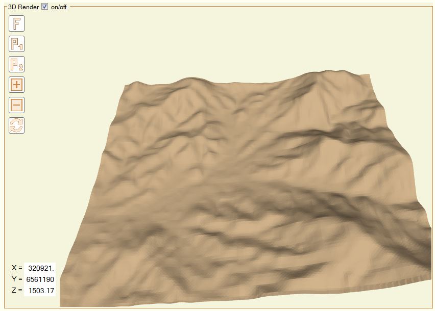
TOPOGRAPHY
Mesh developed using Bing Maps Services® and Kriging interpolation algorithm. This is an inbuilt functionality, all terrain was obtained from within Geo Meshing.
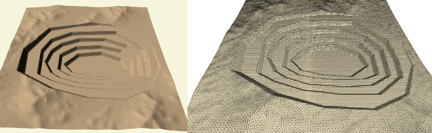
PIT EXCAVATION
Pit excavation developed over a random topography. The pit shape was done using the Polygonal tool.
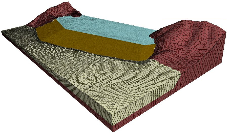
EARTH FILL DAM
An earth fill dam, with three axis alignments, developed using the Dam tool. Notice the refinement area in the dam zone. The refinement reduced the elements size to 1/4 of its original size. The refinement was done in two stages using the Finer mesh tool.
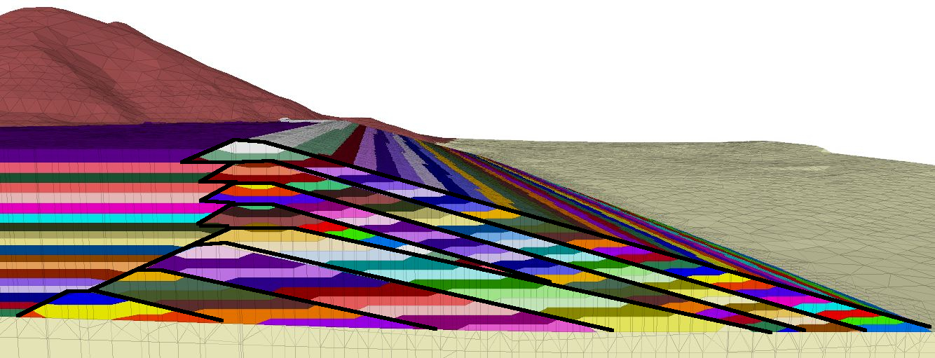
STAGED CONSTRUCTION
Geo Meshing can help to develop construction sequences rapidly. The image shows how Geo Meshing assigns different groups (colors) to each new meshed layer, thus each one of them can be sequentially activated within FLAC3D(R), to simulate a construction sequence. Geo Meshing can cater for downstream, centerline and upstream construction.
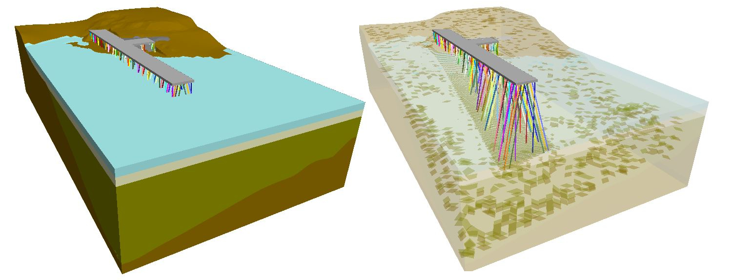
BAY TRESTLE
Geo Meshing can mesh irregular underground surfaces and fill with horizontal layers. Geo Meshing also can be set for perfect interaction with structural elements.
MANUALS

USER MANUAL 4.3
Language: English
Size: 2.2 MB
TUTORIALS
Please Notice: All tutorials have been performed with Geo Meshing 2.6.1. Nevertheless, all these tutorials can be replicated with the current Geo Meshing version.
Tutorial 1 – Basic Concepts
Tutorial 2 – Creating Topography from CAD file
DOWNLOAD
DXF file used in tutorial 2
Tutorial 3 – Creating Topography from online Bing Map Service
Tutorial 4 – Creating a Dam and filling its impoundment
DOWNLOAD
DXF file used in tutorial 4